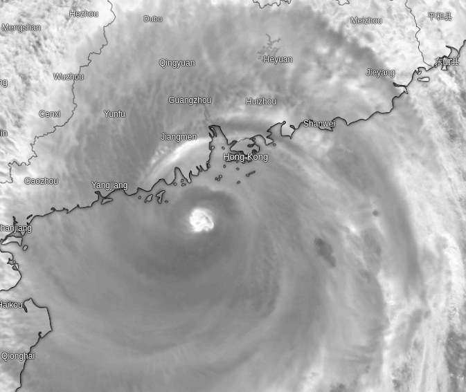
I would consider myself lucky to have been able to experience two T10 signals in less than 10 months in Hong Kong. This time, I realised I would be in the optimal positioning, where I had windows on both the east and north facing side with unobstructed views to fully experience the winds. Starting on the tuesday night of 2025-09-23, Typhoon Ragasa approaches from the west of HK.
2025-09-23T17:30:00+08:00 - There was minimal rain but the wind speeds had already picked up from earlier in the afternoon. Very little clouds up until 2130 HKT.
2025-09-24T00:13:00+08:00 - Winds start to pick up. Squally showers.
2025-09-24T04:52:00+08:00 - Typhoon directly south of HK Island and the wind + rain is at strongest.
2025-09-24T12:05:00+08:00 - Winds have basically subsided with only a few occasional gusts. Typhoon moves westward out of Hong Kong.
>> Home